
A Third Of The Ground: What The Plan Reserves That Is Not Housing
Plan-lot land uses from residential and employment to parks, roads, and antiquities: what each TA/4444 designation permits in Israeli planning, and what the mix tells a buyer about life beyond the tower lobby.
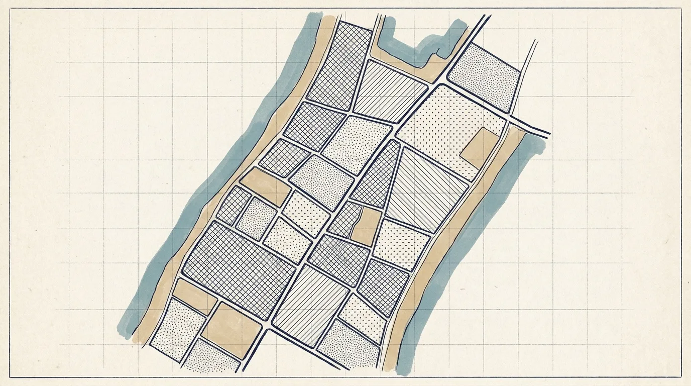
Sixteen Thousand Homes Is Not Sixteen Thousand Lot Polygons
Plan TA/4444, in force from August 2020, programmes about 16,000 housing units on roughly 1,300 dunams of former airfield. That headline number dominates marketing. The same validation sheet programmes about 500,000 square metres of public buildings, about 330,000 square metres of employment, about 125,000 square metres of commerce, about 125,000 square metres of hotels (~3,000 rooms), about 365 dunams of parks, and two kilometres of public beach.
The site's plan-lot data for TA/4444 and TA/3700 lists 186 numbered lots with land-use classifications. Those classes include residential, residential and employment, residential and commerce, public buildings, park, open public space, urban square, approved roads, proposed roads, employment, commerce, private open space, hotel, and antiquities. The distribution is evidence about what the district is planned to be, not only how many bedrooms it will hold.
Marketing sometimes rounds the open-space share to "a third of the ground." The validated park figure (~365 dunams on ~1,300) is closer to a quarter before you add beach, roads, and non-residential buildings. This article follows the lot classifications and program totals, not the roundest slogan.
How Israeli Planning Uses Land-Use Labels
In Israel's statutory planning system, a district plan (tochnit metar, תוכנית מתאר) sets the envelope: uses, densities, and public domains for a large area. A design plan (tochnit itzuv, תוכנית עיצוב) for an individual migrash must fit inside that envelope before a building permit (heter bniya, היתר בנייה) can issue.
A land-use label on the plan map is therefore a permission ceiling, not a building. "Public buildings" reserves ground for schools, clinics, community centres, and similar civic functions. "Park" and "open public space" reserve ground that cannot become private towers. "Approved roads" and "proposed roads" reserve corridors for movement. Mixed labels such as "residential and employment" tell you one lot may carry both homes and workplaces under a single design plan.
Buyers from outside Israel should read the label as a legal category, not as English plain speech. "Commerce" is retail and services floor space, not necessarily a shop open on your move-in date. "Employment" is offices and workplaces. "Hotel" is hospitality use on numbered lots, eight of them on the beachfront in the validated program.
Residential and Mixed Housing Lots
Pure "residential" lots carry housing under TA/4444's stepped skyline rules: binyan mirkami (בנייה מרקמית, fabric buildings) of seven to nine floors lining streets, with towers of 20 to 45 floors set behind them. Eshkol residential lots run 101 through 111. Central residential lots sit in the 2200s. North lots use 3100-series numbers.
"Residential and employment" and "residential and commerce" are mixed migrashim. Dan Real Estate's approved design for Central lot 2208 is recorded as 437 units with a 45-story tower mixing homes, employment, and commerce. Combination deals on private land, such as Dan's March 2025 purchase of 260 units plus 300 square metres of commerce, sit on a different ownership track but the same planning logic: one parcel, multiple uses.
A mixed label protects the plan from becoming bedrooms only. It also means traffic, loading, and operating hours on the podium are part of the file for neighbours on pure residential lots.
Public Buildings, Commerce, and Employment
The validated program budgets about 500,000 square metres of public buildings. Lot 409 in Eshkol is the education and community complex: schools and a community centre, with design approved in August 2024, owned by the Tel Aviv municipality on the catalog's Eshkol lot table. That is a public-buildings migrash with an approved design, not yet a playground you can visit.
Employment space totals about 330,000 square metres district-wide. Eshkol lot 303 carried a conditionally approved design for 26,000 square metres of employment and commerce on Ibn Gvirol in July 2026. Lot 305, employment and commerce for Ravad (רבד), had design approval in May 2026. Lot 306 is the marlog (מרלו"ג, neighbourhood logistics centre) plus offices, won by Pangaea Sde Dov in August 2024.
Commerce totals about 125,000 square metres. Hotels add about 125,000 square metres (~3,000 rooms). The hotels-marina-reading post owns the hospitality tender calendar. Here the point is simpler: those square metres are plan reservations, counted separately from the 16,000 homes.
Lot 409: Aug 2024 approval. Lots 303, 305, 306: district news 2026 and catalog §2b.
Parks, Squares, Open Space, and Private Open Space
Park, open public space, urban square, and private open space are four distinct labels in the lot data. "Park" and "open public space" are public domains in the statutory sense. The parks-and-beach post owns the three headline parks (Coastal, Runway, Linear) and the promenade you can walk today. This section only notes that those grounds appear as their own classes on the lot map, not as leftover gaps between towers.
"Urban square" reserves civic gathering space at street level. "Private open space" reserves courtyards and gardens tied to buildings, including the hatzer be'zikat hana'a (חצר בזיקת הנאה, easement courtyard) network described in the masterplan post: private gardens crossed by public easement paths.
About 365 dunams of parks sit in the validated program, plus two kilometres of beach kept public. Coastal Park alone is listed at about 240 to 265 dunams along that shore. Add roads and building footprints, and the non-housing share of the 1,300 dunams is substantial even before you count employment pods and hotel podiums.
Roads, Hotels, and Antiquities
Approved roads and proposed roads appear as their own land-use classes in the 186-lot dataset. They are not counted inside the residential migrashim. A proposed road polygon is a future right of way. An approved road polygon is further along in the statutory stack. Neither is a guarantee of final asphalt date.
Hotel is its own class on sixteen lots in the program, eight on the beachfront. Eshkol lots 301 and 302 are the first hotel sites with design plans approved in March 2026. DIMRI YAMA on lot 107 includes a hotel component within a residential scheme.
Antiquities appears as a classification in the lot data. The corpus does not expand every antiquities polygon. Treat the label as a protection category: archaeological sensitivity can constrain excavation on or near a lot. PFAS contamination disclosed in February 2026 is a separate environmental file from antiquities, and both can affect timetables.
What the Mix Tells a Buyer
If you buy on lot 101 (ASHIRA) or lot 111 (RAINBOW), your migrash is residential, but your block sits beside employment lots in the 300 series, public lot 409, and road reservations. Your view corridor includes Coastal Park and the public beach, not only neighbour towers.
If you buy in Central on a 2025 tender lot, you are entering a complex with about 6,000 to 7,128 programmed units, five-hotel tourism tenders in March 2025, and senior-living design approvals for Azrieli and Africa Israel in February 2026. The land-use mix says "downtown slice," not "single-use estate."
A district with ~6,900 diur mechalil (דיור מכליל, inclusive housing) units mandated inside the 16,000-home program also reserves long-term rental migrashim (lots 106, 109, 2207, and others) that will never appear on the private for-sale market. The mix is social as well as functional.
| Land-use class | What it permits (planning sense) | Buyer takeaway |
|---|---|---|
| Residential | Housing within TA/4444 height and density rules | Your apartment lot; check fabric vs tower mix on the design plan |
| Residential and employment / commerce | Homes plus workplaces or retail on one migrash | Podium uses, traffic, and hours affect neighbours |
| Public buildings | Schools, clinics, community facilities | Reserved civic ground; opening dates are not on the plan sheet |
| Park / open public space / urban square | Public green and civic open ground | Not buildable as private towers; some promenade already open |
| Approved / proposed roads | Street and highway rights of way | Reservation now, driving later; see getting-to-sde-dov post |
| Employment / commerce | Offices, retail, services | Job and shop floor space; design plans name some winners |
| Hotel | Hospitality use on numbered lots | Tourism traffic; eight beachfront lots in the program |
| Private open space | Building-linked gardens and courtyards | May include public easement paths through blocks |
| Antiquities | Archaeological protection | Can constrain excavation; lot-level file needed |
Classes listed in journal-expansion-corpus.md §5 from apps/web/src/content/lots.ts and sde-dov-lots.geojson.
Program Totals Versus Lot Polygons
The table above explains categories. The validated program totals explain scale. Five hundred thousand square metres of public buildings is a district-sized civic budget. Three hundred and thirty thousand square metres of employment is a job base, not a single office tower. One hundred and twenty-five square metres each of commerce and hotels adds retail and tourism at a scale that matches a new coastal quarter.
The lot dataset does not, in the compiled research, give a single percentage headline for "how much ground is not housing." Honest arithmetic uses the dunam and square-metre figures the plan validated, plus the road and antiquities polygons on the map. Inventing a precise percentage from partial data would violate the site's accuracy rule.
First occupancy targeted around 2029 assumes those non-housing lots will fill in over a build-out toward about 2035, not all on day one. Services and open space often lag the first towers even when the reservation exists on the map.
| Category | Validated scale |
|---|---|
| Public buildings | ~500,000 sqm |
| Employment | ~330,000 sqm |
| Commerce | ~125,000 sqm |
| Hotels | ~125,000 sqm (~3,000 rooms, 16 lots) |
| Parks | ~365 dunams |
| Public beach | 2 km |
Reading the Map Before the Brochure
Developers sell migrashim. Planners sell a district. The lot map with land-use colours is the bridge. A colour labelled "park" is a promise the tower behind it should not expand into the green strip. A colour labelled "public buildings" on lot 409 is a promise that schools and community facilities were counted before the sixteenth tower was drawn.
Cross-reference the migrash number on a contract with the complex map (Eshkol 101 to 111, Central 2200s, North 3100s). Cross-reference the land-use label with the program total for that use. If the brochure says "steps from the park" but the lot map shows a proposed road between you and the park polygon, the map wins.
Where the file does not say how many dunams each non-residential class covers, say so. Where it does give a validated total or a named lot, use that. The district is planned as a city slice, not as a housing estate with green paint on the rendering.
A land-use label is a permission ceiling, not a building you can walk into.
Questions about buying here?
We are an independent guide. Tell us what you are looking at and we will answer with sources.